

Written by Gurjit Ghai, REALTOR®
Rexara Realty Inc.·Published: October 23, 2026·Buying
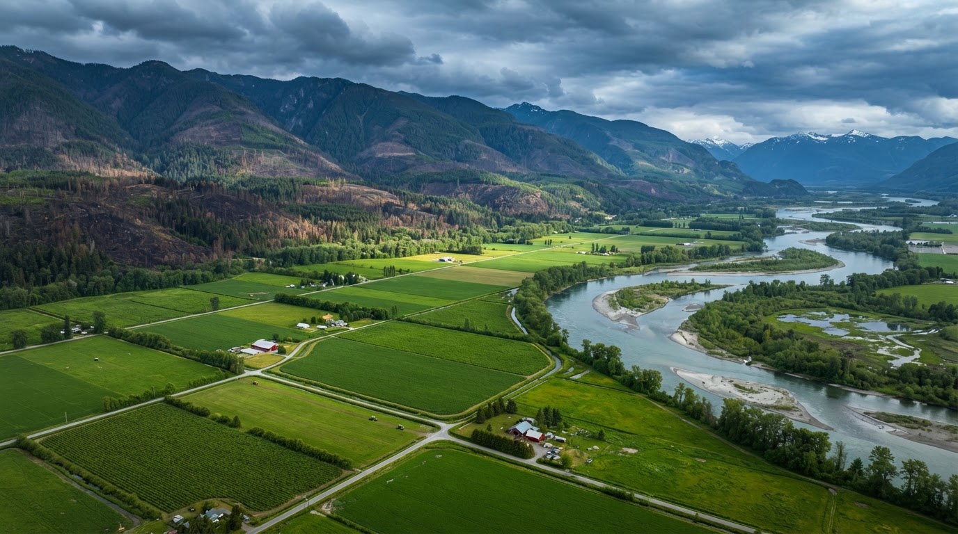
Climate risk has moved from a background environmental concern to a front-and-centre due-diligence item on BC farmland. The 2021 Sumas Prairie flood, the 2023 wildfire season, and recurring drought conditions across the Interior and Okanagan have made it clear that a parcel's exposure to flood, drought, and fire is not an abstract risk — it is a measurable factor that affects insurability, financing terms, operating costs, and long-term land value. This guide explains how to assess each of the three climate risks on a BC farm parcel before you buy, what to check that most buyers miss, and how climate exposure interacts with the ALR, water rights, and farm classification rules this site covers separately.
Climate risk sits at the intersection of several things this site covers in depth: water rights and licences, ALR land-use rules, due diligence, climate and farmland, and the regional farmland comparison guides. This article brings them together into a single climate-risk due-diligence framework — because a parcel that passes every other check can still be a poor buy if its flood, drought, or fire exposure was never assessed.
The short answer
Climate risk on BC farmland breaks into three categories — flood, drought, and wildfire — and each one is region-specific. Flood risk concentrates in the Fraser Valley and low-lying Delta and Richmond parcels; drought and water-allocation stress concentrates in the Okanagan and Interior; and wildfire interface risk concentrates across the Thompson-Nicola, Cariboo, and Kootenay regions. Each risk has its own due-diligence check: floodplain designation and dike/drainage status for flood; water-licence security and aquifer stress for drought; and FireSmart interface zone and insurance availability for wildfire. Check all three before you buy, because a parcel that is safe from one risk can be fully exposed to another.
Why climate risk is now a farmland due-diligence item
For most of the history of BC farm transactions, climate risk was treated as a farming concern — something the operator managed after purchase, not something the buyer assessed before closing. That has changed. The 2021 atmospheric river event that flooded the Sumas Prairie and surrounding Fraser Valley farmland demonstrated that flood exposure on productive agricultural land is not theoretical — it is a recurring, material risk that can destroy a season's crop, damage buildings and infrastructure, and disrupt operations for months. The 2023 wildfire season demonstrated the same for interface risk across the Interior. And recurring drought conditions have made water-allocation security a live question for irrigated land across the Okanagan and Interior.
What makes climate risk a due-diligence item — not just a farming concern — is that it affects three things a buyer cares about before purchase: insurability (can you insure the improvements, and at what cost?), financing (will a lender treat the parcel differently?), and long-term value (will the parcel's productive capacity hold over a 10- or 20-year hold period?). A parcel that is uninsurable after a flood event, or that loses its irrigation allocation in a drought year, or that sits in a wildfire interface zone where insurance is restricted, is a different investment than the same acreage without that exposure — and the price should reflect it.
This is not climate science advice
This guide explains how to identify and assess the three climate risks on a BC farm parcel at a due-diligence level — what to check, where to look it up, and what questions to ask. It is not a substitute for a professional environmental site assessment, a geotechnical engineer's flood-risk opinion, a qualified agronomist's water-adequacy assessment, or an insurance broker's coverage analysis. Engage the right professionals for the specific risk on the specific parcel.
Flood risk: the Fraser Valley, Delta, and Richmond
Flood risk on BC farmland concentrates in the Fraser Valley floodplain and the low-lying agricultural land in Delta and Richmond. The 2021 Sumas Prairie flood was the most visible recent event, but the underlying exposure — a floodplain where productive farmland sits below or near river and drainage levels, protected by a system of dikes, pumps, and drainage infrastructure — is a permanent feature of the geography, not a one-time event. A buyer assessing a Fraser Valley, Delta, or Richmond parcel should understand the floodplain designation, the dike and drainage district status, and the historical flood history of the specific parcel.
The due-diligence checks for flood risk are: (1) confirm whether the parcel is in a designated floodplain under the provincial flood hazard mapping; (2) identify the dike or drainage district that protects the parcel and confirm its maintenance and inspection status; (3) check the historical flood record — has the parcel or adjacent parcels flooded in living memory, and what was the extent; (4) confirm whether the buildings and improvements are elevated or flood-proofed to the standard the local building bylaw requires; and (5) ask an insurance broker whether overland flood coverage is available for the improvements and at what premium and deductible. A parcel where flood insurance is available at a standard premium is a different risk profile than one where coverage is restricted, excluded, or available only at a very high deductible.
Flood risk also interacts with the ALR land-use rules. A parcel in the ALR that is also in a floodplain may face restrictions on fill, building placement, and non-farm-use development that are designed to preserve flood conveyance and storage — which means a buyer's ability to mitigate flood risk by elevating or relocating improvements may be constrained by the same land-use rules that protect the farmland. Check both layers together, not separately.
Drought risk: the Okanagan and Interior
Drought risk on BC farmland is, in practice, a water-rights risk. In the Okanagan and Interior, where irrigated agriculture — vineyards, orchards, forage, and specialty crops — depends on surface water licences and groundwater authorisations, a drought is not just a weather event; it is a stress test of the parcel's water entitlement. In a dry year, the question is not whether it rains less but whether the parcel's water licence or licences are secure enough to maintain the authorised irrigation allocation through a low-flow period — and whether the aquifer or surface source that supplies the licence is itself under stress.
The due-diligence checks for drought risk are: (1) confirm every water licence on the parcel — surface and groundwater — is in good standing under the Water Sustainability Act (see our water rights guide); (2) confirm the authorised use on each licence matches the planned farming operation — a licence authorised for stock-watering does not authorise irrigation, and a licence authorised for a different property does not transfer automatically; (3) assess the source — is the licence on a reliable surface source, a stressed aquifer, or a shared irrigation district with its own allocation rules; (4) check whether the parcel is in an area under a drought or water-shortage declaration, and what restrictions have applied historically; and (5) for groundwater, confirm whether a groundwater licence authorisation has been obtained and is in good standing. See our water licence transfer guide for how water rights transfer in a purchase.
The interaction between drought risk and the ALR is indirect but real: the ALR protects the land for agricultural use, but it does not guarantee the water. A parcel that is excellent ALR farmland with productive soil but an insecure or inadequate water licence is a different investment than the same parcel with secure, adequate irrigation rights — and in the Okanagan and Interior, the water is often the limiting factor, not the soil. A buyer who checks the soil but not the water is doing half the due diligence.
Wildfire risk: the Interior, Thompson-Nicola, and Kootenay
Wildfire risk on BC farmland concentrates in the interface zones — the areas where agricultural land meets forested or wildland vegetation — across the Thompson-Nicola, Cariboo, and Kootenay regions, and in parts of the Okanagan and Interior. The 2023 wildfire season made clear that interface risk is not limited to residential properties; agricultural land in the interface zone faces direct fire threat to buildings, fences, and infrastructure, smoke exposure that affects crops and livestock, and — critically for a buyer — insurance availability and cost in a market where interface coverage has become harder to place.
The due-diligence checks for wildfire risk are: (1) identify whether the parcel is in a wildland-urban interface or fire-prone area using provincial wildfire threat mapping; (2) assess the fuel load and defensible space around buildings and improvements — is the parcel FireSmarted, or is it surrounded by dense vegetation that would carry a fire; (3) check access — is the parcel on a single-access road that could be cut by a fire, and is there an evacuation route; (4) ask an insurance broker whether wildfire coverage is available for the improvements and at what premium and deductible, and whether coverage is subject to a wildfire-season endorsement or exclusion; and (5) for operating farms, assess smoke exposure risk to crops, livestock, and labour availability during a fire event.
Wildfire risk also interacts with the farm classification and operating economics. A farm that loses a season to fire or smoke disruption may lose the gross-income threshold that maintains farm-class tax status — which means a climate event can cascade into a tax-status event. A buyer assessing an interface parcel should understand both the direct fire risk and the indirect risk to the farm's operating and tax status.
A buyer's climate-risk checklist
- 1Identify which of the three climate risks apply to the parcel's region: flood (Fraser Valley, Delta, Richmond), drought (Okanagan, Interior), wildfire (Thompson-Nicola, Cariboo, Kootenay, parts of Okanagan).
- 2For flood: confirm floodplain designation, dike/drainage district status, historical flood record, building elevation, and overland flood insurance availability and cost.
- 3For drought: confirm every water licence is in good standing, that the authorised use matches the planned operation, that the source is reliable, and that groundwater is licensed. See our water rights guide and water licence transfer guide.
- 4For wildfire: confirm interface-zone status, fuel load and defensible space, access and evacuation routes, wildfire insurance availability and cost, and smoke exposure risk to crops and livestock.
- 5Check how each climate risk interacts with the ALR land-use rules — floodplain fill and building restrictions, water-use authorisations, and non-farm-use constraints.
- 6Check how each climate risk interacts with farm classification — a climate event that disrupts a season can affect the gross-income threshold that maintains farm-class tax status.
- 7Ask an insurance broker for a coverage and premium quote on the specific parcel before you remove subjects — not after. Insurance availability and cost are a direct measure of the market's view of the parcel's climate risk.
- 8Ask the seller for any history of flood, drought, water-shortage, or wildfire events on the parcel or adjacent parcels, and any insurance claims.
- 9Consider whether the parcel's price reflects its climate-risk profile — a parcel with full flood, drought, or wildfire exposure should not trade at the same price as an equivalent parcel without it.
- 10Engage the right professionals: a geotechnical engineer for flood opinion, an agronomist for water-adequacy, an insurance broker for coverage, and your real estate professional for the transaction.
Regional climate-risk comparison
| Region | Flood risk | Drought/water risk | Wildfire risk |
|---|---|---|---|
| Fraser Valley | High — floodplain, dike-dependent | Low to moderate | Low to moderate |
| Delta / Richmond | High — low-lying, drainage-dependent | Low | Low |
| Okanagan | Low to moderate | High — water-allocation stress | Moderate to high — interface zones |
| Thompson-Nicola | Low to moderate | High — Interior dry belt | High — interface and rangeland |
| Cariboo | Low | Moderate | High — extensive interface |
| Kootenay | Low to moderate | Moderate | Moderate to high — interface zones |
| Vancouver Island | Low to moderate — coastal | Low to moderate | Low to moderate |
| Metro Vancouver (ALR) | Moderate — low-lying | Low | Low |
This table is a starting point, not a substitute for a parcel-specific assessment. Two parcels in the same region can have very different risk profiles depending on elevation, drainage, water source, fuel load, and the specific dike, drainage, or irrigation district that serves them. Use the table to know which risks to check first — not to decide which risks to ignore.
How climate risk affects insurability, financing, and value
The three practical channels through which climate risk affects a farm purchase are insurability, financing, and long-term value. On insurability: a parcel where overland flood or wildfire coverage is available at a standard premium is a different risk than one where coverage is restricted, subject to a high deductible, or excluded — and a parcel that cannot be insured at all is a parcel most buyers and most lenders will not touch. On financing: a lender assessing a farm mortgage may treat a high-risk parcel differently — higher margin, additional conditions, or in some cases a decline — because the lender is exposed to the same risk and the same potential for a loss that impairs the collateral. On long-term value: a parcel whose productive capacity is degraded by repeated flood, drought, or fire events, or whose water allocation is reduced under a future drought regime, may not hold its value over a 10- or 20-year hold the way an equivalent parcel without that exposure would.
The practical takeaway is that climate risk is a price factor. A buyer who assesses climate risk before purchase can either walk away from a parcel that is overexposed, or negotiate a price that reflects the risk. A buyer who does not assess it is paying the same price as a buyer who is — and absorbing the risk for free. See our due diligence guide for how climate risk fits into the broader farm-buying due-diligence process.
The bottom line
Climate risk on BC farmland is not a future concern — it is a present due-diligence item. Flood exposure in the Fraser Valley, drought and water-allocation stress in the Okanagan and Interior, and wildfire interface risk across the Thompson-Nicola, Cariboo, and Kootenay each affect what a parcel is worth, what it costs to insure, and whether it holds its productive capacity over a long hold. The buyers who do well in this market are the ones who check all three risks before they remove subjects — not the ones who discover them after closing.
If you are assessing a BC farm parcel and want help understanding its flood, drought, or wildfire exposure in the context of the ALR, the water rights, and the farm-class status, contact Gurjit for a due-diligence conversation that starts with the climate risk, not after it.
Important: This information is educational only and is not legal, tax, financial or regulatory advice. ALR rules, water licensing, zoning and farm-classification requirements can change and depend on your specific property and circumstances. Always verify with the relevant BC authorities and qualified professionals before making decisions.
Frequently Asked Questions
- How do I know if a BC farm parcel is in a floodplain?
- Check the provincial flood hazard mapping and the local government's floodplain bylaw maps to confirm whether the parcel is in a designated floodplain. For Fraser Valley, Delta, and Richmond parcels, also identify the dike or drainage district that protects the parcel and confirm its maintenance and inspection status. Ask the seller for any history of flooding on the parcel or adjacent parcels, and ask an insurance broker whether overland flood coverage is available and at what cost. A parcel in a designated floodplain is not necessarily unbuyable, but it should be assessed and priced with its flood exposure in mind.
- Does drought affect BC farmland values?
- Drought affects BC farmland values indirectly through the water-rights layer. In the Okanagan and Interior, where irrigated agriculture depends on surface water licences and groundwater authorisations, a drought stress-tests the parcel's water entitlement. If a licence is insecure, the authorised use does not match the operation, or the source is a stressed aquifer, the parcel's productive capacity — and therefore its value — is at risk in a dry year. A buyer should confirm every water licence is in good standing, that the authorised use matches the planned operation, and that the source is reliable before purchase. See our water rights guide for how to check this.
- Can I get wildfire insurance on a BC farm in an interface zone?
- Wildfire insurance availability on interface-zone farmland depends on the specific parcel, the insurer, and the current market. Some interface parcels are insurable at a standard or moderately elevated premium; others may be subject to a high deductible, a wildfire-season endorsement, or in some cases a coverage restriction or decline. The only way to know is to ask an insurance broker for a quote on the specific parcel before you remove subjects. Insurance availability and cost are a direct, market-based measure of the parcel's wildfire risk — if coverage is hard to place, that is information about the risk, not just about the insurance market.
- How does climate risk interact with ALR land in BC?
- Climate risk and ALR land-use rules interact in two ways. First, a parcel in the ALR that is also in a floodplain may face restrictions on fill, building placement, and non-farm-use development designed to preserve flood conveyance and storage — which can constrain a buyer's ability to mitigate flood risk by elevating or relocating improvements. Second, the ALR protects the land for agricultural use but does not guarantee the water; a parcel that is excellent ALR farmland with an insecure water licence is a different investment than the same parcel with secure irrigation rights. Check both the ALR status and the climate-risk layers together, not separately.
- Should I assess climate risk before buying BC farmland?
- Yes. Climate risk — flood, drought, and wildfire — is now a standard due-diligence item on BC farmland, not a future concern. Each risk affects insurability (can you insure the improvements and at what cost), financing (will a lender treat the parcel differently), and long-term value (will the parcel hold its productive capacity over a 10- or 20-year hold). A buyer who assesses climate risk before purchase can either walk away from an overexposed parcel or negotiate a price that reflects the risk. A buyer who does not is absorbing the risk for free. See our due diligence guide for how climate risk fits into the broader farm-buying process.
- What is the biggest climate risk for Okanagan farmland?
- For Okanagan farmland, the biggest climate risk is drought and water-allocation stress. Okanagan agriculture — vineyards, orchards, and specialty crops — depends heavily on irrigated water, and the region's surface and groundwater sources are under recurring stress. The key due-diligence check is the security and adequacy of the parcel's water licences: confirm every licence is in good standing, that the authorised use matches the planned operation, and that the source is reliable. Wildfire interface risk is also present in parts of the Okanagan and should be assessed alongside the water risk. See our water rights guide and water licence transfer guide for how to check the water layer.
- What is the biggest climate risk for Fraser Valley farmland?
- For Fraser Valley farmland, the biggest climate risk is flood exposure. The Fraser Valley floodplain — including the Sumas Prairie area — is productive agricultural land that sits at or below river and drainage levels, protected by a system of dikes, pumps, and drainage infrastructure. The 2021 atmospheric river flood demonstrated that this exposure is recurring and material. The key due-diligence checks are floodplain designation, dike and drainage district status, historical flood record, building elevation, and overland flood insurance availability and cost. Drought and wildfire risk are lower in the Fraser Valley than in the Interior but should still be confirmed.
Gurjit Ghai, REALTOR®
Personal Real Estate Corporation
Brokerage: Rexara Realty Inc.
Gurjit Ghai is a BC real estate professional specializing in agricultural land, ALR properties, and farm operations across British Columbia. He helps buyers and sellers navigate water rights, soil capability, farm classification, and the unique due diligence that farmland transactions require.